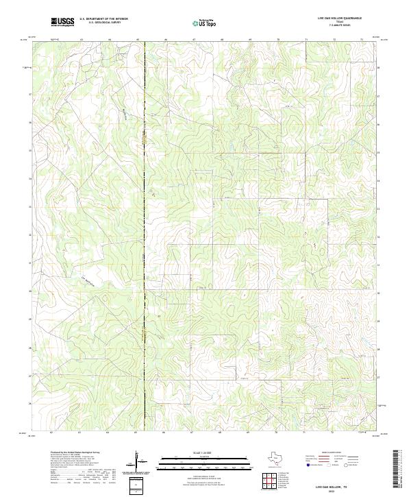
2022 Map of Live Oak Hollow
USGS Topo · Published 2022About this map
Live Oak Hollow and Mud Hollow define the undulating terrain of this South Texas landscape, where the border between McMullen and Live Oak counties is traced by the long stretch of Co Line Rd. This modern topographical study reveals a rural expanse dominated by intermittent drainage systems and a network of county roads. Watercourses such as Live Oak Cr, White Cr, and Rex Cabaniss Cr suggest a landscape shaped by seasonal flow, feeding into larger systems like Salt Br and Leopard Br. The infrastructure is primarily defined by local transit routes like Fm 1873 and Fm 889, which connect the scattered properties and agricultural holdings of this sparsely populated ranching region. The map provides a clear record of the modern property boundaries and transport corridors that maintain the area's rural character.
Find a feature on this map
23 named features on this map. Tap any name to fly to it.
Don’t see what you’re looking for? This feature index may not catch every label — zoom into the map to look around manually.
Map Details
Editions of this 2022 Live Oak Hollow Map
This is the sole edition of this map. No revisions or reprints were ever made.
Other maps of this area

1920 · Mikeska
USGS Topo · 1:125,000

1925 · Simmons No. 1
USGS Topo · 1:48,000

1925 · Simmons No. 2
USGS Topo · 1:48,000

1927 · Oakville
USGS Topo · 1:62,500

1929 · Simmons
USGS Topo · 1:62,500

1953 · Crystal City
USGS Topo · 1:250,000

1955 · Crystal City
USGS Topo · 1:250,000

1961 · Crystal City
USGS Topo · 1:250,000
1963 · Elm Creek
USGS Topo · 1:24,000
1963 · Oakville SW
USGS Topo · 1:24,000