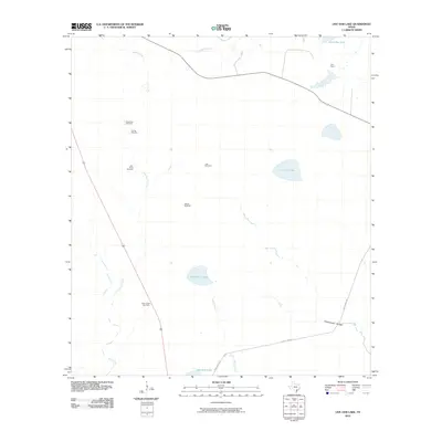
2010 Map of Live Oak Lake
USGS Topo · Published 2010About this map
Sarco Creek Gas Field and a series of livestock-related landmarks define this South Texas landscape in Goliad County. The terrain is marked by essential water infrastructure for ranching, including the Dutch Trap Windmill, Old Vat Windmill, and Little Sarco Windmill. These features indicate the area's continued reliance on groundwater and ranching economies in the early 21st century. Natural water features like Live Oak Lake, Horseshoe Lake, and Hackberry Lake punctuate the scrubland, while the River Ranch settlement sits near the northern boundary. The drainage network, comprising Melon Creek, Sarco Creek, and Little Sarco Creek, flows toward the southern marshes near Bundick Lake. This survey captures a specific intersection of energy extraction and traditional Texas cattle country, where Duke Ranch Rd serves as a primary artery through the sparsely populated coastal plain.
Find a feature on this map
17 named features on this map. Tap any name to fly to it.
Don’t see what you’re looking for? This feature index may not catch every label — zoom into the map to look around manually.
Map Details
Editions of this 2010 Live Oak Lake Map
This is the sole edition of this map. No revisions or reprints were ever made.
Other maps of this area

1953 · Beeville
USGS Topo · 1:250,000

1954 · Vidaurri
USGS Topo · 1:62,500

1954 · Refugio
USGS Topo · 1:62,500

1956 · Beeville
USGS Topo · 1:250,000

1960 · Beeville
USGS Topo · 1:250,000

1962 · Live Oak Lake
USGS Topo · 1:24,000

1962 · Fannin
USGS Topo · 1:24,000

1962 · Lott Lake
USGS Topo · 1:24,000

1962 · Melo
USGS Topo · 1:24,000

1962 · Hensley Lake
USGS Topo · 1:24,000