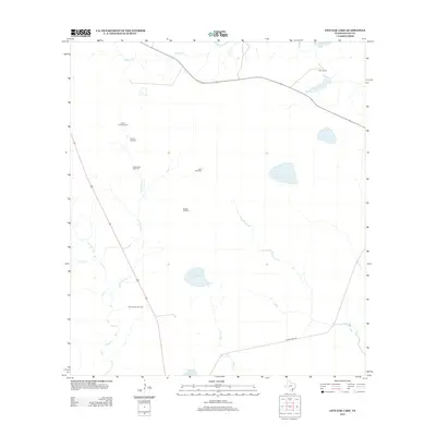
2013 Map of Live Oak Lake
USGS Topo · Published 2013About this map
Sarco Creek Gas Field and the surrounding ranchlands define this corner of Goliad County in the early 21st century. The landscape is characterized by a network of intermittent waterways, including Little Sarco Cr, Buzzard Br, and Melon Cr, which feed several small reservoirs like Live Oak Lake and Hackberry Lake. The map reveals a specialized infrastructure for cattle and resource extraction, with numerous named landmarks serving as navigational anchors for local families. Landmarks like Dutch Trap Windmill, Old Vat Windmill, and Woods Windmill appear alongside larger agricultural operations such as River Ranch. The presence of Duke Ranch Rd and the proximity of Bundick Lake illustrate the enduring importance of water management and private landholdings in this part of South Texas.
Find a feature on this map
17 named features on this map. Tap any name to fly to it.
Don’t see what you’re looking for? This feature index may not catch every label — zoom into the map to look around manually.
Map Details
Editions of this 2013 Live Oak Lake Map
This is the sole edition of this map. No revisions or reprints were ever made.
Other maps of this area

1953 · Beeville
USGS Topo · 1:250,000

1954 · Vidaurri
USGS Topo · 1:62,500

1954 · Refugio
USGS Topo · 1:62,500

1956 · Beeville
USGS Topo · 1:250,000

1960 · Beeville
USGS Topo · 1:250,000

1962 · Live Oak Lake
USGS Topo · 1:24,000

1962 · Fannin
USGS Topo · 1:24,000

1962 · Lott Lake
USGS Topo · 1:24,000

1962 · Melo
USGS Topo · 1:24,000

1962 · Hensley Lake
USGS Topo · 1:24,000