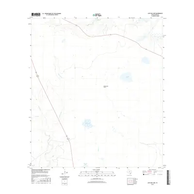
2016 Map of Live Oak Lake
USGS Topo · Published 2016About this map
Live Oak Lake and the winding drainages of Goliad County define this South Texas landscape during the mid-2010s. The area is characterized by a network of seasonal and perennial waterways, including Sarco Cr and its tributary Little Sarco Cr, which carve through the terrain alongside Cottonwood Hollow. These natural features, along with scattered water bodies like Hackberry Lake and Bundick Lake, suggest a pastoral environment largely dedicated to ranching and watershed management. Transport and transit through this rural expanse are anchored by Alt 77 and Highway 183, providing critical links between the remote coastal plains and the interior. To the north, Horseshoe Lake and Cadena Cr mark the transition toward broader floodplains, illustrating the hydrological patterns of the region before the influence of significant modern urban development.
Find a feature on this map
13 named features on this map. Tap any name to fly to it.
Don’t see what you’re looking for? This feature index may not catch every label — zoom into the map to look around manually.
Map Details
Editions of this 2016 Live Oak Lake Map
This is the sole edition of this map. No revisions or reprints were ever made.
Other maps of this area

1953 · Beeville
USGS Topo · 1:250,000

1954 · Vidaurri
USGS Topo · 1:62,500

1954 · Refugio
USGS Topo · 1:62,500

1956 · Beeville
USGS Topo · 1:250,000

1960 · Beeville
USGS Topo · 1:250,000

1962 · Live Oak Lake
USGS Topo · 1:24,000

1962 · Fannin
USGS Topo · 1:24,000

1962 · Lott Lake
USGS Topo · 1:24,000

1962 · Melo
USGS Topo · 1:24,000

1962 · Hensley Lake
USGS Topo · 1:24,000