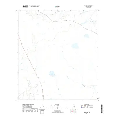
2019 Map of Live Oak Lake
USGS Topo · Published 2019About this map
Live Oak Lake and Hackberry Lake sit at the center of this drainage basin in Goliad County, where the coastal prairie begins its subtle transition toward the interior. The landscape is defined by a dendritic network of seasonal waterways and creeks, including the winding course of Sarco Cr and its tributary Little Sarco Cr in the western reaches. In the north, Cadena Cr cuts through the terrain, while the southeastern corner is marked by the distinct drainage of Cottonwood Hollow. This 2019 survey illustrates a largely rural and undeveloped expanse of South Texas, where water management and natural hydrology remain the dominant physical characteristics. The map captures the subtle elevation changes that direct flow into Melon Cr and other local branches, reflecting the traditional ranching and agricultural character of the region.
Find a feature on this map
8 named features on this map. Tap any name to fly to it.
Don’t see what you’re looking for? This feature index may not catch every label — zoom into the map to look around manually.
Map Details
Editions of this 2019 Live Oak Lake Map
This is the sole edition of this map. No revisions or reprints were ever made.
Other maps of this area

1953 · Beeville
USGS Topo · 1:250,000

1954 · Vidaurri
USGS Topo · 1:62,500

1954 · Refugio
USGS Topo · 1:62,500

1956 · Beeville
USGS Topo · 1:250,000

1960 · Beeville
USGS Topo · 1:250,000

1962 · Live Oak Lake
USGS Topo · 1:24,000

1962 · Fannin
USGS Topo · 1:24,000

1962 · Lott Lake
USGS Topo · 1:24,000

1962 · Melo
USGS Topo · 1:24,000

1962 · Hensley Lake
USGS Topo · 1:24,000