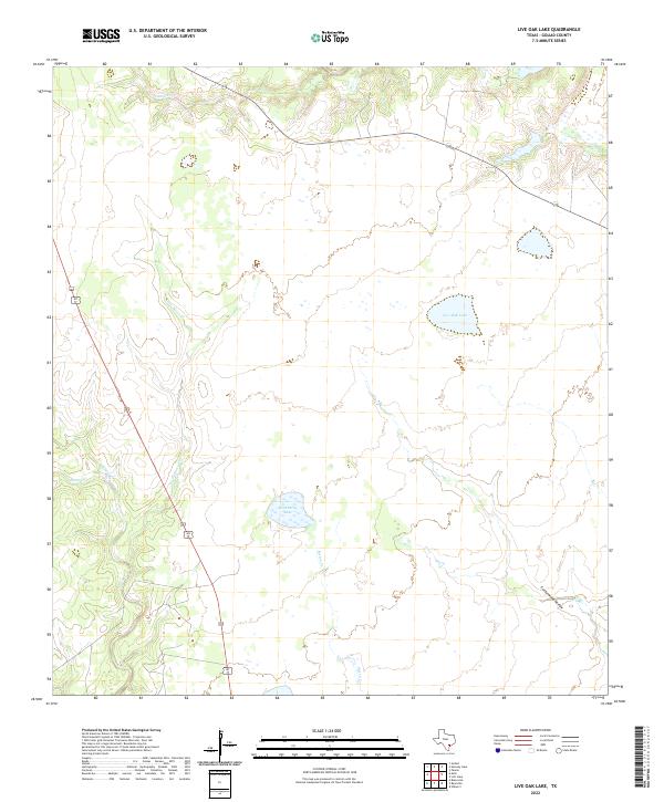
2022 Map of Live Oak Lake
USGS Topo · Published 2022About this map
Live Oak Lake and Hackberry Lake punctuate this low-lying Goliad County landscape, where an intricate network of seasonal drainages and creek beds define the local geography. The area is characterized by a complex hydrographic system featuring Sarco Cr and its tributary Little Sarco Cr, which meander through the western portion of the quadrangle. These waterways, along with Melon Cr to the east, suggest a terrain shaped by intermittent water flow and cattle ranching needs in south-central Texas.
Find a feature on this map
8 named features on this map. Tap any name to fly to it.
Don’t see what you’re looking for? This feature index may not catch every label — zoom into the map to look around manually.
Map Details
Editions of this 2022 Live Oak Lake Map
This is the sole edition of this map. No revisions or reprints were ever made.
Other maps of this area

1953 · Beeville
USGS Topo · 1:250,000

1954 · Vidaurri
USGS Topo · 1:62,500

1954 · Refugio
USGS Topo · 1:62,500

1956 · Beeville
USGS Topo · 1:250,000

1960 · Beeville
USGS Topo · 1:250,000

1962 · Live Oak Lake
USGS Topo · 1:24,000

1962 · Fannin
USGS Topo · 1:24,000

1962 · Lott Lake
USGS Topo · 1:24,000

1962 · Melo
USGS Topo · 1:24,000

1962 · Hensley Lake
USGS Topo · 1:24,000