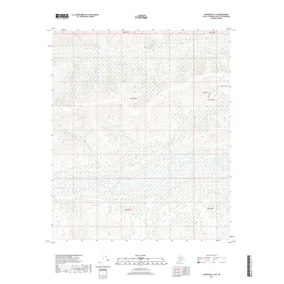
2017 Map of Livengood A-3 SE
USGS Topo · Published 2017About this map
The Chatanika River dominates the southern reaches of this interior Alaskan landscape, winding through a broad valley floor characterized by extensive wetlands. In the northeast, the terrain rises significantly toward a network of ridges accessed by Himilaya Road and the Himilaya Loop. This 2017 survey reveals a transition from the riparian systems of the river and its tributaries, such as Murphy Cr and Hayes Cr, to the higher elevations of the Fairbanks North Star Borough. The presence of Rossburg Road indicates localized access into these uplands, while the northern sections are defined by the drainage of Washington Cr. This map is particularly useful for understanding the hydrologic patterns and contemporary road access in this portion of the Livengood region.
Find a feature on this map
13 named features on this map. Tap any name to fly to it.
Don’t see what you’re looking for? This feature index may not catch every label — zoom into the map to look around manually.
Map Details
Editions of this 2017 Livengood A-3 SE Map
This is the sole edition of this map. No revisions or reprints were ever made.
Other maps of this area

1945 · Livengood
USGS Topo · 1:250,000

1949 · Fairbanks D-2
USGS Topo · 1:62,500

1949 · Fairbanks D-3
USGS Topo · 1:63,360

1950 · Fairbanks
USGS Topo · 1:250,000

1950 · Fairbanks D-3
USGS Topo · 1:63,360

1951 · Fairbanks
USGS Topo · 1:250,000

1951 · Livengood
USGS Topo · 1:250,000

1952 · Fairbanks D-2
USGS Topo · 1:63,360

1952 · Fairbanks D-3
USGS Topo · 1:63,360

1952 · Fairbanks
USGS Topo · 1:250,000