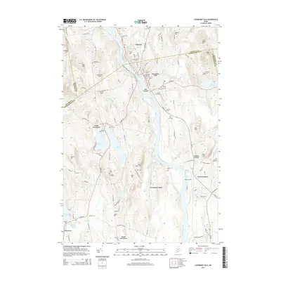
2014 Map of Livermore Falls
USGS Topo · Published 2014About this map
The Androscoggin River carves a central path through this Maine landscape, anchoring industrial and residential hubs at Livermore Falls and Chisholm. The map reveals a dense network of upland farms and rural corners, such as Shy Corner, Haines Corner, and Stones Corner, many of which are marked by family-named landmarks like Richs Mountain and Philbrick Hill. This 2014 survey documents a region where the proximity of water power and river transit shaped the development of towns like North Livermore and East Livermore.
Find a feature on this map
127 named features on this map. Tap any name to fly to it.
Don’t see what you’re looking for? This feature index may not catch every label — zoom into the map to look around manually.
Map Details
Editions of this 2014 Livermore Falls Map
This is the sole edition of this map. No revisions or reprints were ever made.
Other maps of this area

1910 · Livermore
USGS Topo · 1:62,500

1911 · Buckfield
USGS Topo · 1:62,500

1912 · Livermore
USGS Topo · 1:62,500

1913 · Buckfield
USGS Topo · 1:62,500

1924 · Farmington
USGS Topo · 1:62,500

1926 · Dixfield
USGS Topo · 1:62,500

1929 · Dixfield
USGS Topo · 1:62,500

1941 · Livermore
USGS Topo · 1:62,500

1942 · Buckfield
USGS Topo · 1:62,500

1950 · Lewiston
USGS Topo · 1:250,000