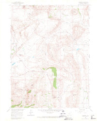
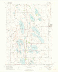
1960 Map of Livermore
USGS Topo · Published 1966About this map
Livermore serves as a central point in this northern Colorado landscape, situated where Red Feather Lakes Road and Cherokee Park Rd meet. The map reveals a working ranching and quarrying environment in the early 1960s, evidenced by Spring Hill Ranch and extractive sites like Rex Quarry and Roberts Quarry. The terrain is defined by dramatic geological formations, including the prominent Grayback Ridge and Steamboat Rock, while the southern portion transitions into the Roosevelt National Forest.
Find a feature on this map
35 named features on this map. Tap any name to fly to it.
Don’t see what you’re looking for? This feature index may not catch every label — zoom into the map to look around manually.
Map Details
Editions of this 1960 Livermore Map
4 editions found
Other maps of this area

1906 · Fort Collins
USGS Topo · 1:62,500

1907 · Livermore
USGS Topo · 1:125,000

1908 · Fort Collins
USGS Topo · 1:62,500

1909 · Livermore
USGS Topo · 1:125,000

1954 · Greeley
USGS Topo · 1:250,000

1957 · Greeley
USGS Topo · 1:250,000

1958 · Greeley
USGS Topo · 1:250,000

1960 · Livermore
USGS Topo · 1:24,000
1960 · Buckeye
USGS Topo · 1:24,000
1960 · Wellington
USGS Topo · 1:24,000