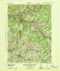
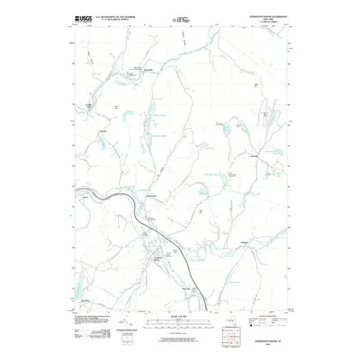
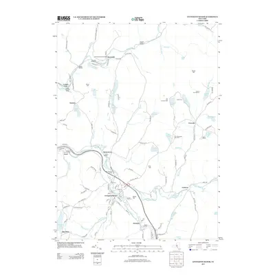
1944 Map of Livingston Manor
USGS Topo · Published 1944About this map
The New York Ontario and Western RR follows the winding path of the Beaver Kill and Willowemoc Creek in this mid-century portrait of Sullivan County. This landscape reveals a complex rural industrial economy where specialized facilities like the Dye Works, Acid Plant, and Creosote Plant are positioned near river valleys and rail access. The settlement of Livingston Manor serves as a central hub, surrounded by a dense network of upland schoolhouses including Morton Hill Sch and Dahlia Sch, reflecting the distributed nature of the township population before school consolidation. The terrain is defined by significant ridges like Loomis Chestnut Ridge and numerous bodies of water, from the sizeable Waneta Lake and Tennanah Lake to secluded spots like The Punchbowl. Roads such as the Liberty Highway connect established communities like Roscoe, Rockland, and White Sulphur Springs, providing a detailed look at the Catskill region's infrastructure during the war years.
Find a feature on this map
79 named features on this map. Tap any name to fly to it.
Don’t see what you’re looking for? This feature index may not catch every label — zoom into the map to look around manually.
Map Details
Editions of this 1944 Livingston Manor Map
This is the sole edition of this map. No revisions or reprints were ever made.
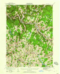
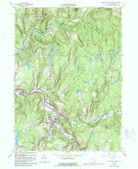
Historical Maps of Liberty Through Time
9 maps found
1921 Livingston Manor
Sullivan County, NY
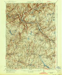
1923 Livingston Manor
Sullivan County, NY
1944 Livingston Manor
Sullivan County, NY
1965 Livingston Manor
Sullivan County, NY
2010 Livingston Manor
Sullivan County, NY
2013 Livingston Manor
Sullivan County, NY
2016 Livingston Manor
Sullivan County, NY
2019 Livingston Manor
Sullivan County, NY

2023 Livingston Manor
Sullivan County, NY