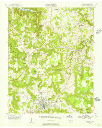
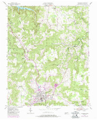
1955 Map of Livingston
USGS Topo · Published 1956About this map
Livingston serves as the hub of this mid-century Overton County landscape, where the town street grid is surrounded by a patchwork of upland farms and timbered ridges. To the west, the boundaries of Standingstone State Park encompass the Standingstone Mill, while the northern edge of the map reveals the waters of Dale Hollow Reservoir. The terrain is defined by prominent family-named heights such as Reynolds Mountain and Miller Mountain, separated by deep coves and hollows. Local community life is deeply rooted in its rural infrastructure, evidenced by numerous small country schools like Independence Sch and the Oak Grove Sch, alongside landmark churches including Howard Chapel and Free Communion Ch. This survey provides a rare look at the area before significant modern development, preserving the locations of legacy sites like Garretts Mill and the Drive-in Theater just east of the city center.
Find a feature on this map
53 named features on this map. Tap any name to fly to it.
Don’t see what you’re looking for? This feature index may not catch every label — zoom into the map to look around manually.
Map Details
Editions of this 1955 Livingston Map
5 editions found
Other maps of this area

1897 · Standingstone
USGS Topo · 1:125,000

1898 · Standingstone
USGS Topo · 1:125,000

1924 · Lillydale
USGS Topo · 1:62,500

1926 · Lillydale
USGS Topo · 1:62,500

1929 · Lillydale
USGS Topo · 1:62,500

1929 · Byrdstown
USGS Topo · 1:62,500

1944 · Livingston
USGS Topo · 1:24,000

1951 · Windle
USGS Topo · 1:24,000

1954 · Crawford
USGS Topo · 1:24,000
1955 · Hilham
USGS Topo · 1:24,000