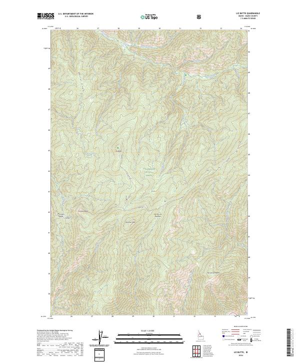
2024 Map of Liz Butte
USGS Topo · Published 2024About this map
Weitas Ridge and high-elevation landforms define this portion of the Clearwater National Forest, where the landscape remains largely defined by its natural topography rather than permanent settlement. The historic Lolo Trl crosses the southern portion of the quadrangle, passing through Sherman Saddle and near Sherman Peak, tracing a route long used for traverse through these highlands. To the north, the terrain drops toward the drainage of Weitas Creek, while the southern edge is bounded by the Middle Fork Clearwater Wild and Scenic River. The presence of named features like No-see-um Meadows and Liz Butte suggest the specialized vocabulary of forestry and backcountry navigation, as Liz Butte Rd provides one of the few managed access points into this interior drainage network.
Find a feature on this map
30 named features on this map. Tap any name to fly to it.
Don’t see what you’re looking for? This feature index may not catch every label — zoom into the map to look around manually.
Map Details
Editions of this 2024 Liz Butte Map
This is the sole edition of this map. No revisions or reprints were ever made.
Other maps of this area

1911 · Lolo
USGS Topo · 1:250,000

1913 · Lolo
USGS Topo · 1:250,000

1956 · Hamilton
USGS Topo · 1:250,000

1959 · Hamilton
USGS Topo · 1:250,000

1960 · Hamilton
USGS Topo · 1:250,000

1964 · Hamilton
USGS Topo · 1:250,000

1965 · Lean-to Point
USGS Topo · 1:24,000

1965 · Lookout Peak
USGS Topo · 1:24,000
1965 · Cook Mountain
USGS Topo · 1:24,000
1966 · Weitas Butte
USGS Topo · 1:24,000