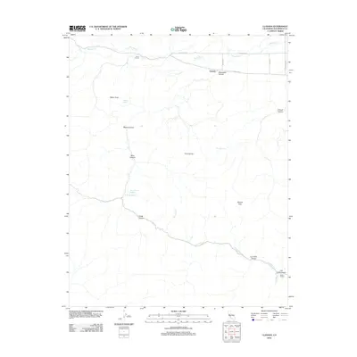
2012 Map of Llanada
USGS Topo · Published 2012About this map
Llanada and the surrounding rangeland of the Diablo Range are defined by a network of seasonal watercourses and prominent ridges. The northern reaches follow the path of Panoche Cr, where Cherry Hill Cem sits near the junction of Yturriarte Rd and Panoche Rd. The terrain is marked by significant elevations like Walker Peak and Cerro Bonito, giving way to a system of deep drainages including Bitterwater Canyon and Mine Canyon. To the south, the Strohn Rancho area is characterized by the winding course of Pimental Cr as it flows through Log Cabin Canyon and Van Cliff Canyon. Several isolated water sources, such as Albañez Spring and Parrot Spring, suggest the critical importance of water management in this semi-arid landscape. This topography reflects a long history of ranching and early mining activity in a remote corner of San Benito County.
Find a feature on this map
23 named features on this map. Tap any name to fly to it.
Don’t see what you’re looking for? This feature index may not catch every label — zoom into the map to look around manually.
Map Details
Editions of this 2012 Llanada Map
This is the sole edition of this map. No revisions or reprints were ever made.
Other maps of this area

1913 · Panoche
USGS Topo · 1:125,000

1915 · Priest Valley
USGS Topo · 1:125,000

1919 · San Benito
USGS Topo · 1:62,500

1921 · Metz
USGS Topo · 1:62,500

1931 · San Benito
USGS Topo · 1:62,500

1940 · Metz
USGS Topo · 1:62,500

1940 · San Benito
USGS Topo · 1:62,500

1943 · Hernandez Valley
USGS Topo · 1:62,500

1944 · Hernandez Valley
USGS Topo · 1:62,500

1944 · Panoche Valley
USGS Topo · 1:62,500