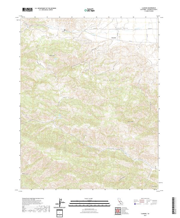
2021 Map of Llanada
USGS Topo · Published 2021About this map
Llanada sits within the expansive topography of San Benito County, nestled in a landscape defined by the Diablo Range and the sweeping Panoche Valley. This 2021 USGS topographic map documents a region characterized by rugged canyons and vital, intermittent water sources. To the south, Pimental Valley and the Vallecitos region are carved by numerous drainage systems, including Pimental Creek and Log Cabin Canyon. For those researching local history or genealogy, the presence of Cherry Hill Cem near the northern boundary provides a significant point of interest. The map also details essential water sources like Albañez Spring, Buck Spring, and Parrot Spring, which have historically been critical in this arid environment. Transportation routes such as Co HWY j1 and New Idria RD connect the scattered landmarks, while prominent heights like Walker Peak, Meyers Peak, and Cerro Bonito offer vantage points over the intricate network of canyons, such as Bitterwater Canyon and Smoker Canyon.
Find a feature on this map
32 named features on this map. Tap any name to fly to it.
Don’t see what you’re looking for? This feature index may not catch every label — zoom into the map to look around manually.
Map Details
Editions of this 2021 Llanada Map
This is the sole edition of this map. No revisions or reprints were ever made.
Other maps of this area

1913 · Panoche
USGS Topo · 1:125,000

1915 · Priest Valley
USGS Topo · 1:125,000

1919 · San Benito
USGS Topo · 1:62,500

1921 · Metz
USGS Topo · 1:62,500

1931 · San Benito
USGS Topo · 1:62,500

1940 · Metz
USGS Topo · 1:62,500

1940 · San Benito
USGS Topo · 1:62,500

1943 · Hernandez Valley
USGS Topo · 1:62,500

1944 · Hernandez Valley
USGS Topo · 1:62,500

1944 · Panoche Valley
USGS Topo · 1:62,500