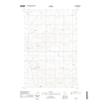
2020 Map of Lloyd
USGS Topo · Published 2020About this map
Bears Paw Mountains define the southern horizon of this high-plains landscape, where the small settlement of Lloyd sits tucked near the base of Lloyd Butte. The terrain here is a complex arrangement of high divides and deep coulees, with Taylor Divide and Mans Head Rock serving as prominent landmarks for navigation across the open range. Drainage patterns are well-defined by intermittent waterways such as Snake Cr, Gold Cr, and Spring Cr, which have carved out features like Prairie Gulch and Jessen Coulee.
Find a feature on this map
23 named features on this map. Tap any name to fly to it.
Don’t see what you’re looking for? This feature index may not catch every label — zoom into the map to look around manually.
Map Details
Editions of this 2020 Lloyd Map
This is the sole edition of this map. No revisions or reprints were ever made.
Other maps of this area

1953 · Havre
USGS Topo · 1:250,000

1956 · Maddux
USGS Topo · 1:62,500

1956 · Rattlesnake
USGS Topo · 1:62,500

1956 · Lloyd
USGS Topo · 1:62,500

1956 · Cleveland
USGS Topo · 1:62,500

1957 · Havre
USGS Topo · 1:250,000

1958 · Havre
USGS Topo · 1:250,000
1987 · Cleveland NW
USGS Topo · 1:24,000
1987 · Sayer Butte
USGS Topo · 1:24,000
1987 · Cleveland
USGS Topo · 1:24,000