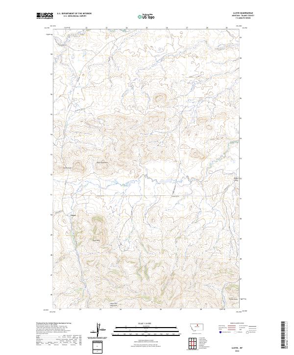
2024 Map of Lloyd
USGS Topo · Published 2024About this map
The Bears Paw Mountains rise above the high plains in this northern Montana landscape, where the small community of Lloyd serves as a central point of settlement. The terrain is defined by dramatic geological features such as Mans Head Rock and the high ridge of Taylor Divide, which separates the drainages of the region. A network of seasonal and perennial waterways, including Snake Creek and Spring Creek, carves through the undulating topography, reflecting the area's deep-rooted ranching and grazing heritage. High points like Lloyd Butte and Crown Butte overlook the vast open spaces of Blaine County, where local travel still relies on established routes like Lloyd Rd and Crown Butte Rd that connect isolated properties and prominent landmarks across the sections.
Find a feature on this map
22 named features on this map. Tap any name to fly to it.
Don’t see what you’re looking for? This feature index may not catch every label — zoom into the map to look around manually.
Map Details
Editions of this 2024 Lloyd Map
This is the sole edition of this map. No revisions or reprints were ever made.
Other maps of this area

1953 · Havre
USGS Topo · 1:250,000

1956 · Maddux
USGS Topo · 1:62,500

1956 · Rattlesnake
USGS Topo · 1:62,500

1956 · Lloyd
USGS Topo · 1:62,500

1956 · Cleveland
USGS Topo · 1:62,500

1957 · Havre
USGS Topo · 1:250,000

1958 · Havre
USGS Topo · 1:250,000
1987 · Cleveland NW
USGS Topo · 1:24,000
1987 · Sayer Butte
USGS Topo · 1:24,000
1987 · Cleveland
USGS Topo · 1:24,000