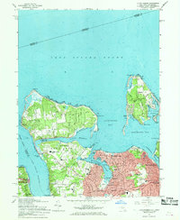
1967 Map of Lloyd Harbor
USGS Topo · Published 1968About this map
The coastal peninsulas of Lloyd Neck and Eatons Neck dominate this 1967 survey, defining the sheltered waters of Lloyd Harbor and Huntington Bay. This period captures the Gold Coast's transition from private estates to institutional use, evidenced by the Immaculate Conception Seminary and the preservation of Sagamore Hill Nat Hist Site. The residential expansion of Huntington and Halesite is marked by a concentration of mid-century educational facilities like the Nathan Hale Sch and Flower Hill Sch. Along the shoreline, the maritime culture of the era is preserved through several recreational and utility landmarks, including the Huntington Yacht Club, the U S Coast Guard Station at Eatons Neck Point, and the Lloyd Harbor Beach Club. This map serves as an excellent record of North Shore settlement patterns before further modernization.
Find a feature on this map
61 named features on this map. Tap any name to fly to it.
Don’t see what you’re looking for? This feature index may not catch every label — zoom into the map to look around manually.
Map Details
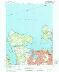
Editions of this 1967 Lloyd Harbor Map
2 editions found
Other maps of this area

1892 · Stamford
USGS Topo · 1:62,500

1892 · Norwalk
USGS Topo · 1:62,500

1893 · Stamford
USGS Topo · 1:62,500

1893 · Norwalk
USGS Topo · 1:62,500

1897 · Oyster Bay
USGS Topo · 1:62,500

1898 · Oyster Bay
USGS Topo · 1:62,500

1899 · Stamford
USGS Topo · 1:62,500

1900 · Oyster Bay
USGS Topo · 1:62,500

1901 · Northport
USGS Topo · 1:62,500

1903 · Northport
USGS Topo · 1:62,500