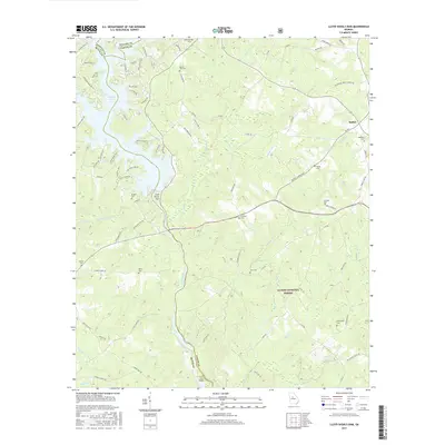
2017 Map of Lloyd Shoals Dam
USGS Topo · Published 2017About this map
Lloyd Shoals Dam controls the flow where the Ocmulgee River begins, downstream from the southern reaches of Jackson Lake. This 2017 survey shows the surrounding rural landscape where the boundaries of Butts, Jasper, and Newton counties converge. The terrain is defined by a dense network of tributaries including Kinnard Cr, Herds Cr, and Persons Creek, which cut through the protected lands of the Oconee National Forest.
Find a feature on this map
94 named features on this map. Tap any name to fly to it.
Don’t see what you’re looking for? This feature index may not catch every label — zoom into the map to look around manually.
Map Details
Editions of this 2017 Lloyd Shoals Dam Map
This is the sole edition of this map. No revisions or reprints were ever made.
Other maps of this area

1951 · Forsyth
USGS Topo · 1:62,500

1953 · Athens
USGS Topo · 1:250,000

1958 · Athens
USGS Topo · 1:250,000

1959 · Athens
USGS Topo · 1:250,000

1963 · Athens
USGS Topo · 1:250,000

1964 · Lloyd Shoals Dam
USGS Topo · 1:24,000
1964 · Jackson
USGS Topo · 1:24,000

1964 · Stewart
USGS Topo · 1:24,000

1964 · Hillsboro
USGS Topo · 1:24,000

1964 · Worthville
USGS Topo · 1:24,000