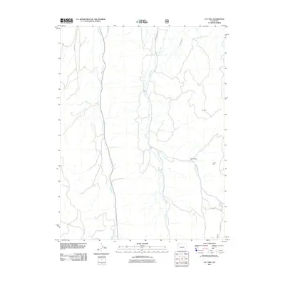
2011 Map of LO 7 Hill
USGS Topo · Published 2011About this map
Sheep Creek and Flag Creek define the vertical drainage patterns of this high-altitude landscape in Rio Blanco County, where the topography rises toward the namesake summit of LO 7 Hill. The 2011 survey reveals an environment shaped by water management and transit routes through difficult terrain. Infrastructure like the Miller Creek Ditch and the Wilson Dam near Red Canyon demonstrate the modification of local waterways to support ranching or resource needs. Transportation is limited to a network of rural routes, including County Rd 13 and Gooseberry Aspen Road, which follow the natural contours of the drainages. The presence of the Hay Flat Trl suggests a transition from motorable roads to more primitive access points as the elevation shifts toward the high mesa country.
Find a feature on this map
14 named features on this map. Tap any name to fly to it.
Don’t see what you’re looking for? This feature index may not catch every label — zoom into the map to look around manually.
Map Details
Editions of this 2011 LO 7 Hill Map
This is the sole edition of this map. No revisions or reprints were ever made.
Other maps of this area

1906 · Grand Hogback
USGS Topo · 1:125,000

1907 · White River
USGS Topo · 1:125,000

1910 · Danforth Hills
USGS Topo · 1:125,000

1910 · Grand Hogback
USGS Topo · 1:125,000

1910 · White River
USGS Topo · 1:125,000

1912 · Meeker
USGS Topo · 1:62,500

1914 · Meeker
USGS Topo · 1:62,500

1952 · No Name Ridge
USGS Topo · 1:24,000

1952 · Segar Mountain
USGS Topo · 1:24,000

1954 · Vernal
USGS Topo · 1:250,000