
1952 Map of Segar Mountain
USGS Topo · Published 1954About this map
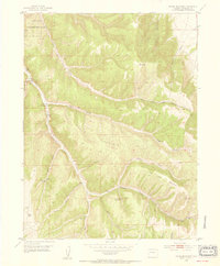
Little Hills Game Experiment Station anchors the northwestern corner of this 1952 study, situated near a dedicated Fish Hatchery and the steep walls of Dark Cañon. The landscape is dominated by the massive ridge of Segar Mountain, which divides the northern drainage of East Fork Hay Gulch from the southern reaches of Piceance Creek. The map documents a rugged cattle-and-resource economy in Rio Blanco County, with the Oldland Cow Camp positioned near the center and a solitary Gas Well and Gas Wells Pumps appearing to the southwest. The intricate drainage network, including Joe Bush Gulch and Timber Gulch, reveals a high-altitude environment where water sources like Post Gulch Spring and Timber Gulch Spring No 3 were vital for the seasonal livestock operations and wildlife management of the early 1950s.
Find a feature on this map
25 named features on this map. Tap any name to fly to it.
Don’t see what you’re looking for? This feature index may not catch every label — zoom into the map to look around manually.
Map Details
Editions of this 1952 Segar Mountain Map
5 editions found
Other maps of this area

1906 · Grand Hogback
USGS Topo · 1:125,000

1907 · White River
USGS Topo · 1:125,000

1910 · Danforth Hills
USGS Topo · 1:125,000

1910 · Grand Hogback
USGS Topo · 1:125,000

1910 · White River
USGS Topo · 1:125,000

1912 · Meeker
USGS Topo · 1:62,500

1914 · Meeker
USGS Topo · 1:62,500

1952 · Jessup Gulch
USGS Topo · 1:24,000

1952 · Greasewood Gulch
USGS Topo · 1:24,000

1952 · No Name Ridge
USGS Topo · 1:24,000