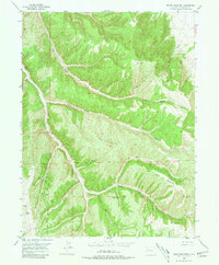
1952 Map of Segar Mountain
USGS Topo · Published 1981About this map
Oldland Cow Camp sits at the confluence of several prominent drainages in this mid-century look at Rio Blanco County. The landscape is defined by the massive Segar Mountain and Joe Bush Mountain, which dictate the complex network of deep ravines including Hay Gulch, Segar Gulch, and Timber Gulch. This 1952 field-checked survey documents a period when the high country was primarily utilized for seasonal livestock operations and emerging resource extraction, evidenced by the presence of scattered Gas Wells and the Meyers benchmark. Essential water sources for the cattle camps of the era are carefully plotted, including Post Gulch Spring and Timber Gulch Spring No 3. This map captures a sparsely populated but active range before modern infrastructure altered the primitive, unimproved routes through these canyons.
Find a feature on this map
26 named features on this map. Tap any name to fly to it.
Don’t see what you’re looking for? This feature index may not catch every label — zoom into the map to look around manually.
Map Details
Editions of this 1952 Segar Mountain Map
5 editions found

Other maps of this area

1906 · Grand Hogback
USGS Topo · 1:125,000

1907 · White River
USGS Topo · 1:125,000

1910 · Danforth Hills
USGS Topo · 1:125,000

1910 · Grand Hogback
USGS Topo · 1:125,000

1910 · White River
USGS Topo · 1:125,000

1912 · Meeker
USGS Topo · 1:62,500

1914 · Meeker
USGS Topo · 1:62,500

1952 · Jessup Gulch
USGS Topo · 1:24,000

1952 · Greasewood Gulch
USGS Topo · 1:24,000

1952 · No Name Ridge
USGS Topo · 1:24,000