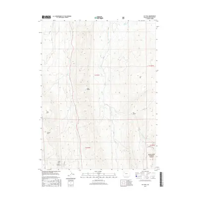
2016 Map of LO 7 Hill
USGS Topo · Published 2016About this map
LO 7 Hill rises as a prominent landmark in this section of Rio Blanco County, where the high-altitude terrain is defined by the striking ridge of the Grand Hogback. The map illustrates a landscape shaped by water management and ranching history, evidenced by the Highland Ditch and Miller Cr Ditch that traverse the northern slopes. These irrigation features speak to the human effort required to sustain life and agriculture in this environment. To the south, the boundary of the White River National Forest marks a transition into protected woodlands, while the seasonal flow of Sheep Cr and its tributaries carve deep recesses like Joe Bush Gulch and Timber Gulch. The isolated settlement of Summer Camp Gulch reflects the area's seasonal use, likely tied to livestock grazing or resource management in the early 21st century.
Find a feature on this map
24 named features on this map. Tap any name to fly to it.
Don’t see what you’re looking for? This feature index may not catch every label — zoom into the map to look around manually.
Map Details
Editions of this 2016 LO 7 Hill Map
This is the sole edition of this map. No revisions or reprints were ever made.
Other maps of this area

1906 · Grand Hogback
USGS Topo · 1:125,000

1907 · White River
USGS Topo · 1:125,000

1910 · Danforth Hills
USGS Topo · 1:125,000

1910 · Grand Hogback
USGS Topo · 1:125,000

1910 · White River
USGS Topo · 1:125,000

1912 · Meeker
USGS Topo · 1:62,500

1914 · Meeker
USGS Topo · 1:62,500

1952 · No Name Ridge
USGS Topo · 1:24,000

1952 · Segar Mountain
USGS Topo · 1:24,000

1954 · Vernal
USGS Topo · 1:250,000