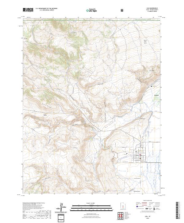
2023 Map of Loa
USGS Topo · Published 2023About this map
Loa serves as the focal point of this 2023 survey, anchored by the Wayne County Courthouse at the heart of the settlement. The town is situated in Rabbit Valley, where a complex network of irrigation infrastructure like the Loa Town Ditch and the Fremont Loa Ditch supports the local agriculture, drawing water toward the fields from the Fremont River. To the north, the settlement of Fremont sits near the edge of the Fishlake National Forest, while the landscape is defined by the dramatic rise of the Awapa Plateau and Black Ridge to the west.
Find a feature on this map
57 named features on this map. Tap any name to fly to it.
Don’t see what you’re looking for? This feature index may not catch every label — zoom into the map to look around manually.
Map Details
Editions of this 2023 Loa Map
This is the sole edition of this map. No revisions or reprints were ever made.
Other maps of this area

1885 · Fish Lake
USGS Topo · 1:250,000

1896 · Fish Lake
USGS Topo · 1:250,000

1952 · Loa 1 SE
USGS Topo · 1:24,000

1952 · Loa 1 NE
USGS Topo · 1:24,000

1956 · Salina
USGS Topo · 1:250,000

1960 · Salina
USGS Topo · 1:250,000

1962 · Salina
USGS Topo · 1:250,000

1967 · Lyman
USGS Topo · 1:24,000

1968 · Fish Lake
USGS Topo · 1:24,000
1968 · Burrville
USGS Topo · 1:24,000