
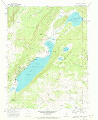
1968 Map of Fish Lake
USGS Topo · Published 1972About this map
Fish Lake and the high-elevation alpine terrain of the Fish Lake National Forest define this 1968 survey. The landscape is a network of water and seasonal transport, with the Johnson Valley Reservoir and numerous springs like Tasha Spring and Hi Spring feeding into the basin. Recreation and management are centered around the Fish Lake Ranger Sta, supported by multiple camps such as Mackinaw Campground and the Bowery Creek Campground.
Find a feature on this map
52 named features on this map. Tap any name to fly to it.
Don’t see what you’re looking for? This feature index may not catch every label — zoom into the map to look around manually.
Map Details
Editions of this 1968 Fish Lake Map
2 editions found
Other maps of this area

1885 · Fish Lake
USGS Topo · 1:250,000

1896 · Fish Lake
USGS Topo · 1:250,000

1952 · Loa 1 NE
USGS Topo · 1:24,000

1956 · Salina
USGS Topo · 1:250,000

1960 · Salina
USGS Topo · 1:250,000

1962 · Salina
USGS Topo · 1:250,000

1967 · Lyman
USGS Topo · 1:24,000
1968 · Hilgard Mtn
USGS Topo · 1:24,000
1968 · Boobe Hole Reservoir
USGS Topo · 1:24,000
1968 · Mt Terrill
USGS Topo · 1:24,000