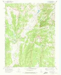
1968 Map of Hilgard Mtn
USGS Topo · Published 1972About this map
Fish Lake National Forest dominates this 1968 landscape, where the high-elevation terrain of the U M Plateau transitions into a network of steep canyons and alpine basins. The map illustrates a remote backcountry managed through sites like the Clear Creek Guard Station and a system of primitive routes, including the Jeep Trail and Pack Trail networks. Water management for the surrounding Sevier County region is evident through high-mountain catchments such as Sheep Valley Res and Willies Flat Reservoir. Distinctive geologic and topographical markers like the volcanic-looking The Pot Holes, the prominent Hilgard Mtn, and Windstorm Peak define the horizon. This survey captures the mid-century infrastructure of the national forest before modern recreation became more formalized, preserving the locations of springs, hollows, and family-named landmarks like Yens Peters Gap.
Find a feature on this map
36 named features on this map. Tap any name to fly to it.
Don’t see what you’re looking for? This feature index may not catch every label — zoom into the map to look around manually.
Map Details
Editions of this 1968 Hilgard Mtn Map
2 editions found
Other maps of this area

1885 · Fish Lake
USGS Topo · 1:250,000

1896 · Fish Lake
USGS Topo · 1:250,000

1922 · Emery No.3
USGS Topo · 1:31,680

1925 · Acord Lakes
USGS Topo · 1:62,500

1956 · Salina
USGS Topo · 1:250,000

1960 · Salina
USGS Topo · 1:250,000

1962 · Salina
USGS Topo · 1:250,000

1966 · Yogo Creek
USGS Topo · 1:24,000
1966 · Gooseberry Creek
USGS Topo · 1:24,000

1968 · Johns Peak
USGS Topo · 1:24,000