1925 Map of Acord Lakes
USGS Topo · Published 1925About this map
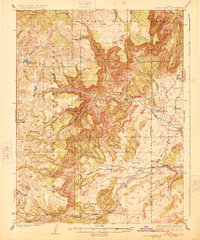
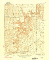
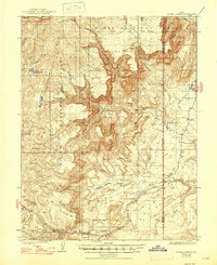
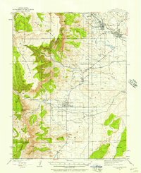
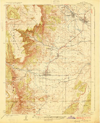
Emery and its outlying ranching and mining operations occupy this high-plateau landscape during the early 1920s. The map illustrates a transitional economy where remote family outposts like Peacocks Place, Jensen Place, and Lewis Ranch sit alongside early extractive industries. The Browning Mine and Knight Mine highlight the region's developing mineral resources, while the presence of the Manti National Forest and Fishlake National Forest boundaries indicates federal land management's role in the area. Water management is critical in this environment, as seen in the Skumpah Reservoir and the naming of vital water sources like Acord Lakes and Oak Spring Ranch. The dramatic topography is defined by the Benches and deep drainages of Quitchupah Creek and Ivie Creek, which dictate the placement of early roads and cabin sites.
Find a feature on this map
54 named features on this map. Tap any name to fly to it.
Don’t see what you’re looking for? This feature index may not catch every label — zoom into the map to look around manually.
Map Details
Editions of this 1925 Acord Lakes Map
3 editions found
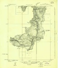
Other maps of this area

1885 · Manti
USGS Topo · 1:250,000

1885 · Fish Lake
USGS Topo · 1:250,000

1895 · Manti
USGS Topo · 1:250,000

1896 · Fish Lake
USGS Topo · 1:250,000
1922 · Emery No.3
USGS Topo · 1:31,680

1922 · Wasatch
USGS Topo · 1:31,680
1923 · Castle Dale
USGS Topo · 1:62,500
1925 · Castle Dale
USGS Topo · 1:62,500

1956 · Salina
USGS Topo · 1:250,000

1956 · Price
USGS Topo · 1:250,000