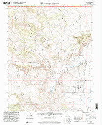
2001 Map of Loa
USGS Topo · Published 2003About this map
Rabbit Valley serves as the focal point of this Wayne County landscape, where the town of Loa is situated along the banks of the Fremont River. The map reveals a community deeply connected to its water sources and topography, featuring the Loa Fish Hatchery and local community landmarks like the Rodeo Grounds and Loa Cem. To the west, the elevation rises sharply toward the Awapa Plateau and the high terrain of Black Ridge, much of which is protected within the Fishlake National Forest. Numerous named water sources, including Bullberry Spring and Potter Spring, drain through deep incisions like Riley Canyon and Sheep Hollow, illustrating the complex drainage patterns required for life and agriculture in this high-desert valley.
Find a feature on this map
40 named features on this map. Tap any name to fly to it.
Don’t see what you’re looking for? This feature index may not catch every label — zoom into the map to look around manually.
Map Details
Editions of this 2001 Loa Map
This is the sole edition of this map. No revisions or reprints were ever made.
Other maps of this area

1885 · Fish Lake
USGS Topo · 1:250,000

1896 · Fish Lake
USGS Topo · 1:250,000

1952 · Loa 1 SE
USGS Topo · 1:24,000

1952 · Loa 1 NE
USGS Topo · 1:24,000

1956 · Salina
USGS Topo · 1:250,000

1960 · Salina
USGS Topo · 1:250,000

1962 · Salina
USGS Topo · 1:250,000

1967 · Lyman
USGS Topo · 1:24,000

1968 · Fish Lake
USGS Topo · 1:24,000
1968 · Burrville
USGS Topo · 1:24,000