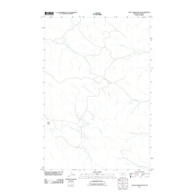
2011 Map of Loaf of Bread Butte
USGS Topo · Published 2011About this map
Loaf of Bread Butte defines the western horizon of this Custer County landscape, overlooking an intricate network of seasonal drainages that characterize the high plains of eastern Montana. The map reveals a complex hydrographic system where Second Creek and its primary tributaries, including the North Fork Second Creek and South Fork Second Creek, carve through the terrain. These waterways, along with others like Fivemile Creek and Timothy Creek, dictate the movement and settlement patterns in this ranching country. Sparse road networks follow the natural contours established by these creek beds and ridges, illustrating the relationship between the physical geography and rural infrastructure in the early 21st century. The survey provides a clear view of the drainage patterns from Johnson Creek in the north to MS Creek in the south.
Find a feature on this map
9 named features on this map. Tap any name to fly to it.
Don’t see what you’re looking for? This feature index may not catch every label — zoom into the map to look around manually.
Map Details
Editions of this 2011 Loaf of Bread Butte Map
This is the sole edition of this map. No revisions or reprints were ever made.
Other maps of this area

1953 · Miles City
USGS Topo · 1:250,000

1957 · Miles City
USGS Topo · 1:250,000

1958 · Miles City
USGS Topo · 1:250,000

1969 · Haines Springs
USGS Topo · 1:24,000

1969 · Mizpah
USGS Topo · 1:24,000

1969 · First Creek
USGS Topo · 1:24,000

1969 · Loaf of Bread Butte
USGS Topo · 1:24,000

1969 · Forty Creek
USGS Topo · 1:24,000

1969 · Locate SE
USGS Topo · 1:24,000

1969 · Miles City Creek
USGS Topo · 1:24,000