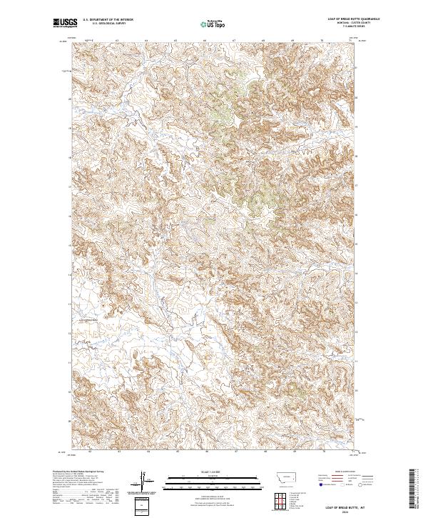
2024 Map of Loaf of Bread Butte
USGS Topo · Published 2024About this map
Loaf of Bread Butte serves as a prominent landmark in this section of Custer County, rising above a landscape defined by an intricate network of drainages. The area is dominated by the forks of Second Creek, including both the North Fork Second Creek and the South Fork Second Creek, which carve through the high plains terrain. This modern survey illustrates the enduring rural character of eastern Montana, where traditional land divisions such as t5n r50e and t6n r51e continue to organize the sparsely settled territory. Water remains the primary shaper of the land here, with Fivemile Creek and Johnson Creek threading through the northern reaches, supporting the open range and localized ranching operations that have characterized the region for generations.
Find a feature on this map
14 named features on this map. Tap any name to fly to it.
Don’t see what you’re looking for? This feature index may not catch every label — zoom into the map to look around manually.
Map Details
Editions of this 2024 Loaf of Bread Butte Map
This is the sole edition of this map. No revisions or reprints were ever made.
Other maps of this area

1953 · Miles City
USGS Topo · 1:250,000

1957 · Miles City
USGS Topo · 1:250,000

1958 · Miles City
USGS Topo · 1:250,000

1969 · Haines Springs
USGS Topo · 1:24,000

1969 · Mizpah
USGS Topo · 1:24,000

1969 · First Creek
USGS Topo · 1:24,000

1969 · Loaf of Bread Butte
USGS Topo · 1:24,000

1969 · Forty Creek
USGS Topo · 1:24,000

1969 · Locate SE
USGS Topo · 1:24,000

1969 · Miles City Creek
USGS Topo · 1:24,000