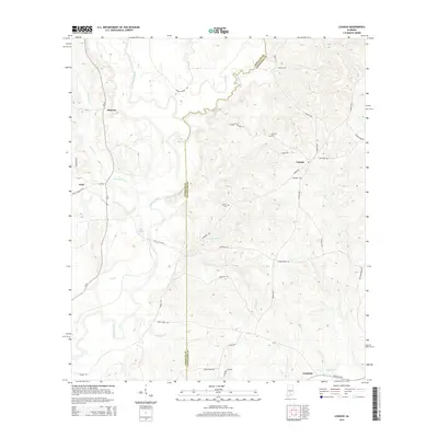
2014 Map of Loango
USGS Topo · Published 2014About this map
The Sepulga River and Pigeon Creek define the winding hydrology of this South Alabama borderland between Conecuh and Covington counties. In the early 21st century, the landscape remains a complex network of timber tracts and rural crossroads, centered on the historic settlement of Loango. To the west, Melrose and Paul sit near the river's upper reaches, while Fairfield anchors the southeast corner along Brooklyn Rd.
Find a feature on this map
46 named features on this map. Tap any name to fly to it.
Don’t see what you’re looking for? This feature index may not catch every label — zoom into the map to look around manually.
Map Details
Editions of this 2014 Loango Map
This is the sole edition of this map. No revisions or reprints were ever made.
Other maps of this area

1953 · Andalusia
USGS Topo · 1:250,000

1957 · Andalusia
USGS Topo · 1:250,000

1971 · Dixie
USGS Topo · 1:24,000

1971 · Brooks
USGS Topo · 1:24,000

1971 · Carolina
USGS Topo · 1:24,000

1971 · River Falls
USGS Topo · 1:24,000

1971 · Red Level
USGS Topo · 1:24,000

1971 · Loango
USGS Topo · 1:24,000

1982 · Damascus
USGS Topo · 1:24,000

1982 · Old Town
USGS Topo · 1:24,000