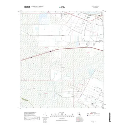
2018 Map of Lobdell
USGS Topo · Published 2018About this map
Allendale and the surrounding river-parish communities sit atop a landscape defined by the heavy infrastructure of the Lower Mississippi region. The modern utility of the Intracoastal Waterway and the Port Allen Canal cut through vast wetlands, including the Alligator Bayou and Choctaw Basin Drainage Canal. This network of man-made waterways serves the industrial and maritime needs of West Baton Rouge Parish, while long-established settlements like Brusly, Addis, and Kahns cluster along the higher ground near the river. Genealogical interest is particularly high here, with several distinct burial grounds such as Saint Catherine Cem, Allendale Cem, and the Greater Shiloh Missionary Cem preserved amidst the evolving transport corridors. The map also documents the Louisiana Technical College Port Allen Extension Campus near Ithra, highlighting the area's role as an educational and industrial hub in the late 2010s.
Find a feature on this map
83 named features on this map. Tap any name to fly to it.
Don’t see what you’re looking for? This feature index may not catch every label — zoom into the map to look around manually.
Map Details
Editions of this 2018 Lobdell Map
This is the sole edition of this map. No revisions or reprints were ever made.
Other maps of this area

1906 · Bayou Sara
USGS Topo · 1:125,000

1908 · Baton Rouge
USGS Topo · 1:62,500

1939 · Zachary
USGS Topo · 1:62,500

1939 · Baton Rouge
USGS Topo · 1:62,500

1940 · Grosse Tete
USGS Topo · 1:62,500

1953 · Baton Rouge West
USGS Topo · 1:24,000

1953 · Plaquemine
USGS Topo · 1:24,000

1953 · Lobdell
USGS Topo · 1:24,000

1953 · Addis
USGS Topo · 1:24,000

1953 · Grosse Tete SW
USGS Topo · 1:24,000