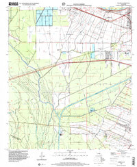
1998 Map of Lobdell
USGS Topo · Published 2000About this map
Gulf Intracoastal Waterway cuts a distinct path through the Lowlands of West Baton Rouge Parish, highlighting the industrial and maritime infrastructure of the late 20th century. This landscape is defined by its complex drainage network, where Choctaw Bayou and Alligator Bayou meander through a region marked by subsidence. The map reveals the proximity of sugar-country settlements like Lobdell and Allendale to growing modern facilities, including the Port Allen Voc-Tech Sch and the Green Lake Oil and Gas Field. Genealogists will find several burial grounds and places of worship, such as the Greater Shiloh Missionary Cem and Brown Ch, which anchor the local communities. The presence of Fish Ponds and large sewage disposal facilities near the waterway illustrates the varied land use between agricultural traditions and modern utility requirements.
Find a feature on this map
40 named features on this map. Tap any name to fly to it.
Don’t see what you’re looking for? This feature index may not catch every label — zoom into the map to look around manually.
Map Details
Editions of this 1998 Lobdell Map
This is the sole edition of this map. No revisions or reprints were ever made.
Other maps of this area

1906 · Bayou Sara
USGS Topo · 1:125,000

1908 · Baton Rouge
USGS Topo · 1:62,500

1939 · Zachary
USGS Topo · 1:62,500

1939 · Baton Rouge
USGS Topo · 1:62,500

1940 · Grosse Tete
USGS Topo · 1:62,500

1953 · Baton Rouge West
USGS Topo · 1:24,000

1953 · Plaquemine
USGS Topo · 1:24,000

1953 · Lobdell
USGS Topo · 1:24,000

1953 · Addis
USGS Topo · 1:24,000

1953 · Grosse Tete SW
USGS Topo · 1:24,000