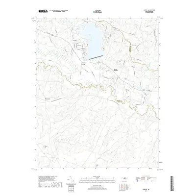
2019 Map of Lobelia
USGS Topo · Published 2019About this map
Lake Surf dominates the northern landscape of this Moore County region, surrounded by a dense network of residential corridors including Oak Grove Rd and Greenbriar Dr. The terrain is defined by the winding course of the Little River, which draws a natural boundary as it flows eastward through the center of the sheet. Small settlements like Lobelia and Mount Pleasant serve as local anchors, connected by historic routes and river crossings such as the Morrison Bridge.
Find a feature on this map
89 named features on this map. Tap any name to fly to it.
Don’t see what you’re looking for? This feature index may not catch every label — zoom into the map to look around manually.
Map Details
Editions of this 2019 Lobelia Map
This is the sole edition of this map. No revisions or reprints were ever made.
Other maps of this area

1948 · Southern Pines
USGS Topo · 1:62,500

1948 · Clifdale
USGS Topo · 1:62,500

1948 · Nicholson Creek
USGS Topo · 1:24,000

1948 · Clifdale
USGS Topo · 1:24,000

1948 · Mc Cain
USGS Topo · 1:24,000

1950 · Clifdale
USGS Topo · 1:24,000

1950 · Sanatorium
USGS Topo · 1:24,000

1950 · Lobelia
USGS Topo · 1:24,000

1950 · Niagara
USGS Topo · 1:24,000

1950 · Nicholson Creek
USGS Topo · 1:24,000