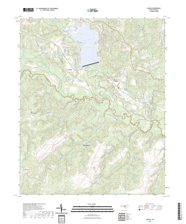
2022 Map of Lobelia
USGS Topo · Published 2022About this map
The Little River meanders across the central landscape of this southern North Carolina region, where the borders of Moore, Harnett, and Hoke counties converge. The community of Lobelia serves as a focal point near the northern shore of Lake Surf, a significant water body fed by Crane Creek. The terrain is defined by low-lying wetlands and creek drainages, punctuated by distinct rises such as Johnson Mtn and Gaddys Mtn to the south. Historically significant road networks, including Lobelia Rd and the Manchester Road & Raeford-Vass Rd, connect smaller settlements like Mount Pleasant and Inverness. This area reflects a classic Sandhills pattern of scattered residential development and rural crossroads linked by a dense network of named local lanes, such as Purvis Johnson Rd and Flynn Mcpherson Rd, which likely indicate long-standing family landholdings in the region.
Find a feature on this map
87 named features on this map. Tap any name to fly to it.
Don’t see what you’re looking for? This feature index may not catch every label — zoom into the map to look around manually.
Map Details
Editions of this 2022 Lobelia Map
This is the sole edition of this map. No revisions or reprints were ever made.
Other maps of this area

1948 · Southern Pines
USGS Topo · 1:62,500

1948 · Clifdale
USGS Topo · 1:62,500

1948 · Nicholson Creek
USGS Topo · 1:24,000

1948 · Clifdale
USGS Topo · 1:24,000

1948 · Mc Cain
USGS Topo · 1:24,000

1950 · Clifdale
USGS Topo · 1:24,000

1950 · Sanatorium
USGS Topo · 1:24,000

1950 · Lobelia
USGS Topo · 1:24,000

1950 · Niagara
USGS Topo · 1:24,000

1950 · Nicholson Creek
USGS Topo · 1:24,000