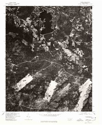
1976 Map of Lobelia
USGS Topo · Published 1978About this map
Mt Pleasant anchors this 1976 orthophotograph, showing the rural landscape of Hoke County during a transitional period for North Carolina agriculture. Unlike traditional topographic maps, this imagery-based study, produced by the Geological Survey in cooperation with the Soil Conservation Service, provides a direct view of land use patterns. Large, cleared tracts of farmland and complex drainage networks are visible, punctuated by dense woodland and significant water bodies. The orthoimagery captures the precise footprint of small homesteads and the road network as it existed in the mid-1970s, offering a specialized look at the region's topography and soil conservation efforts that standard line-and-tint maps often generalize.
Find a feature on this map
1 named feature on this map. Tap any name to fly to it.
Don’t see what you’re looking for? This feature index may not catch every label — zoom into the map to look around manually.
Map Details
Editions of this 1976 Lobelia Map
This is the sole edition of this map. No revisions or reprints were ever made.
Other maps of this area

1948 · Southern Pines
USGS Topo · 1:62,500

1948 · Clifdale
USGS Topo · 1:62,500

1948 · Nicholson Creek
USGS Topo · 1:24,000

1948 · Clifdale
USGS Topo · 1:24,000

1948 · Mc Cain
USGS Topo · 1:24,000

1950 · Clifdale
USGS Topo · 1:24,000

1950 · Sanatorium
USGS Topo · 1:24,000

1950 · Lobelia
USGS Topo · 1:24,000

1950 · Niagara
USGS Topo · 1:24,000

1950 · Nicholson Creek
USGS Topo · 1:24,000