
1936 Map of Lobelville
USGS Topo · Published 1936About this map
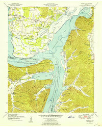
The Buffalo River winds through the heart of Perry County, defining the agricultural and industrial life of Lobelville in the mid-1930s. This Tennessee Valley Authority survey captures a river-dependent economy, most notably evidenced by the Lobelville Mill & and Power House situated near Mill Bridge. The landscape is a network of ridges and hollows, such as Dividing Ridge and Apple Orchard Hollow, where small communities and family farmsteads established their own schools and cemeteries. Local history is deeply etched into the terrain through features like the Bone Spring Sch No 13 and the Terrapin Sch, alongside numerous family burial grounds including Leeper Cem and Jones Cem. The presence of a Stone Quarry and a Gaging Station on the river reflects the era's focus on resource management and infrastructure development during the early years of the TVA's influence in the region.
Find a feature on this map
80 named features on this map. Tap any name to fly to it.
Don’t see what you’re looking for? This feature index may not catch every label — zoom into the map to look around manually.
Map Details
Editions of this 1936 Lobelville Map
This is the sole edition of this map. No revisions or reprints were ever made.
Other maps of this area

1936 · Pleasantville
USGS Topo · 1:24,000

1936 · Hurricane Mills
USGS Topo · 1:24,000

1936 · Coble
USGS Topo · 1:24,000

1936 · Pine View
USGS Topo · 1:24,000

1936 · Daniels Landing
USGS Topo · 1:24,000

1936 · Bucksnort
USGS Topo · 1:24,000

1936 · Chestnut Grove
USGS Topo · 1:24,000

1936 · Hustburg
USGS Topo · 1:24,000

1949 · Daniels Landing
USGS Topo · 1:24,000
1949 · Hustburg
USGS Topo · 1:24,000