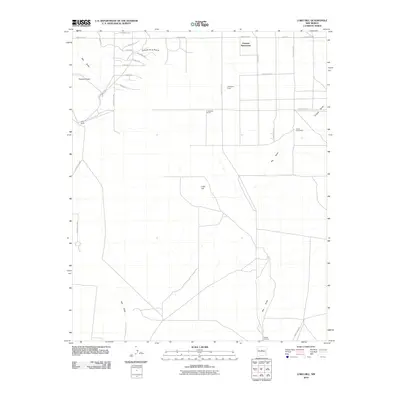
2010 Map of Lobo Hill
USGS Topo · Published 2010About this map
Lobo Hill rises from the high plains of Torrance County, serving as a primary landmark in a landscape defined by expansive ranching operations and intermittent watercourses. In the northern reaches, the development of Estancia Ranchettes and the infrastructure of the Moriarty Airport indicate the modern footprint of human activity, while names like Lamb Homestead and Ranch Huntley preserve the area's agricultural heritage. The terrain is marked by seasonal drainage patterns, most notably Big Draw and Salt Draw, which channel the region's limited precipitation across the plateau. The grid-like road system, featuring routes such as Loma Loop and Stagecoach Rd, connects isolated family operations including the D Williams Ranch and Davis Ranch, reflecting the enduring rural character of this New Mexican corridor during the early 21st century.
Find a feature on this map
30 named features on this map. Tap any name to fly to it.
Don’t see what you’re looking for? This feature index may not catch every label — zoom into the map to look around manually.
Map Details
Editions of this 2010 Lobo Hill Map
This is the sole edition of this map. No revisions or reprints were ever made.
Other maps of this area

1892 · San Pedro
USGS Topo · 1:125,000

1894 · Lamy
USGS Topo · 1:125,000

1917 · Estancia
USGS Topo · 1:125,000

1954 · Santa Fe
USGS Topo · 1:250,000

1954 · Fort Sumner
USGS Topo · 1:250,000

1954 · Socorro
USGS Topo · 1:250,000

1956 · Edgewood
USGS Topo · 1:62,500

1956 · Estancia
USGS Topo · 1:62,500

1958 · Socorro
USGS Topo · 1:250,000

1958 · Fort Sumner
USGS Topo · 1:250,000