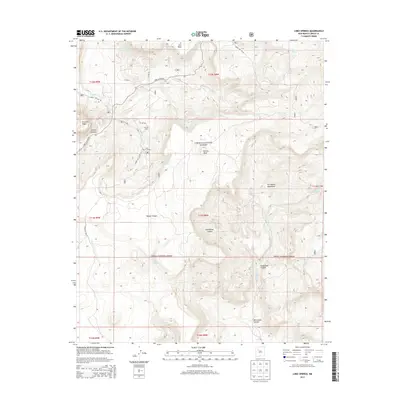
2013 Map of Lobo Springs
USGS Topo · Published 2013About this map
Tietjen Ranch sits at the northern end of Grants Canyon, marking a rare point of private settlement within the high-altitude landscape of Cibola National Forest. This 2013 survey of the San Mateo Mountains illustrates a terrain defined by massive volcanic features and deep drainages, notably Tafoya Canyon and Guadalupe Canyon. The network of forest service roads, including Forest Svc 450 Rd and Lobo Canyon Rd, provides access to the Lobo Picnic Ground and several mesas like Horace Mesa and La Jara Mesa. Hydrology is characterized by seasonal flows and named water sources such as Lobo Cr and East Lobo Spring, which were vital for ranching and forest management. The map details the rugged transition from the E Grants Ridge into the higher peaks, where Rinconada Cr descends toward Rinconada Canyon.
Find a feature on this map
40 named features on this map. Tap any name to fly to it.
Don’t see what you’re looking for? This feature index may not catch every label — zoom into the map to look around manually.
Map Details
Editions of this 2013 Lobo Springs Map
This is the sole edition of this map. No revisions or reprints were ever made.
Other maps of this area

1883 · Mt. Taylor
USGS Topo · 1:250,000

1886 · Mt. Taylor
USGS Topo · 1:250,000

1892 · Mt. Taylor
USGS Topo · 1:250,000

1899 · Mt. Taylor
USGS Topo · 1:250,000

1957 · Lobo Springs
USGS Topo · 1:24,000

1957 · Mount Taylor
USGS Topo · 1:24,000

1957 · Dos Lomas
USGS Topo · 1:24,000

1957 · Grants SE
USGS Topo · 1:24,000

1957 · Mc Cartys
USGS Topo · 1:24,000

1957 · Cubero
USGS Topo · 1:24,000