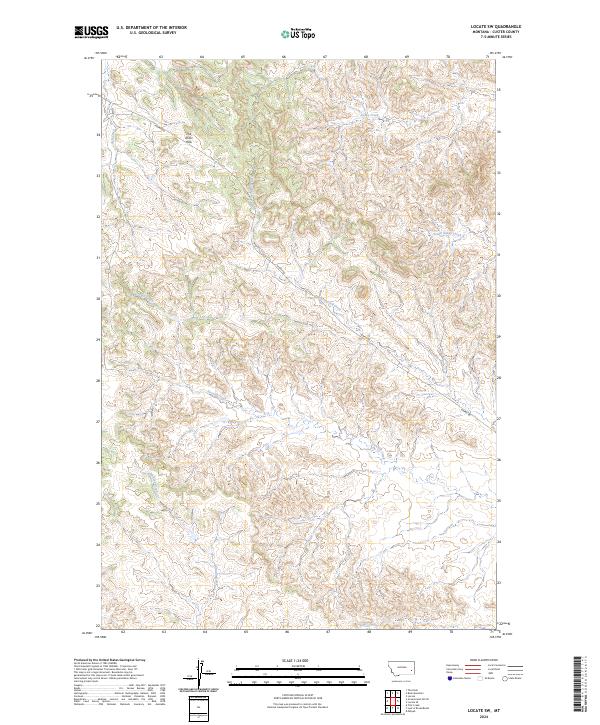
2024 Map of Locate SW
USGS Topo · Published 2024About this map
The Pine Hills rise across the northern landscape of this Custer County quadrangle, defining a complex system of drainages that flow through the Montana rangeland. This 2024 topographic study by the U.S. Geological Survey captures a sparsely settled terrain where land use is dictated by the deeply incised paths of Strevell Creek and Johnson Creek. The primary corridor through this open country is Mispah Rd, which winds southeast toward the North Strevell Creek basin. The map reveals the intricate network of seasonal waterways like Laney Creek and South Laney Creek, illustrating the natural water-management patterns essential to this high plains environment. For those researching land-ownership boundaries or the physical evolution of the Custer County backcountry, the detailed contouring and Public Land Survey System data provide a precise record of the contemporary landscape.
Find a feature on this map
13 named features on this map. Tap any name to fly to it.
Don’t see what you’re looking for? This feature index may not catch every label — zoom into the map to look around manually.
Map Details
Editions of this 2024 Locate SW Map
This is the sole edition of this map. No revisions or reprints were ever made.
Other maps of this area

1953 · Miles City
USGS Topo · 1:250,000

1957 · Miles City
USGS Topo · 1:250,000

1958 · Miles City
USGS Topo · 1:250,000

1969 · Haines Springs
USGS Topo · 1:24,000

1969 · Mizpah
USGS Topo · 1:24,000

1969 · First Creek
USGS Topo · 1:24,000

1969 · Loaf of Bread Butte
USGS Topo · 1:24,000

1969 · Locate SE
USGS Topo · 1:24,000

1969 · The Knob
USGS Topo · 1:24,000

1969 · Buck Mountain
USGS Topo · 1:24,000