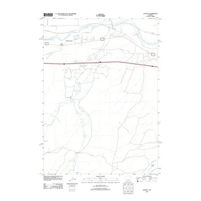
2012 Map of Lockett
USGS Topo · Published 2012About this map
The N Platte River anchors the northern portion of this Natrona County landscape, flowing past the residential pocket of Meadow Acres and the railroad stop at Lockett. To the south, the terrain transitions into a region of traditional ranching and industrial development. Historic family operations including the Old Altman Ranch, Lamb Ranch, and Milne Ranch are spread across a drainage network defined by the Big Muddy and Muddy Cr. The Brooks Ranch Oil Field occupies the central part of the quadrangle, illustrating the persistent role of resource extraction in this Wyoming corridor. Modern infrastructure, including the highway system and various rural roads like Co RD 605, provides access to the higher ground of Cow Hollow and the southern reaches near Banner Draw.
Find a feature on this map
32 named features on this map. Tap any name to fly to it.
Don’t see what you’re looking for? This feature index may not catch every label — zoom into the map to look around manually.
Map Details
Editions of this 2012 Lockett Map
This is the sole edition of this map. No revisions or reprints were ever made.
Other maps of this area

1949 · Brookhurst
USGS Topo · 1:24,000

1949 · Campbell Hill
USGS Topo · 1:24,000

1949 · Parkerton
USGS Topo · 1:24,000

1949 · Glenrock NW
USGS Topo · 1:24,000

1949 · Pratts Soda Lakes
USGS Topo · 1:24,000

1950 · Campbell Hill
USGS Topo · 1:24,000

1950 · Lockett
USGS Topo · 1:24,000

1950 · Brookhurst
USGS Topo · 1:24,000

1950 · Parkerton
USGS Topo · 1:24,000

1950 · Glenrock NW
USGS Topo · 1:24,000