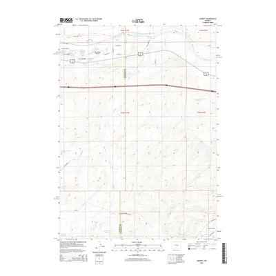
2015 Map of Lockett
USGS Topo · Published 2015About this map
The North Platte River winds through this High Plains landscape, marking the northern transition from the riparian corridor to the arid uplands where the Natrona Co Converse Co boundary line runs south. This 2015 survey reveals the residential clustering at Meadow Acres and the smaller settlement of Cow Hollow, situated near where Dry Cr meets the river's south bank. To the east, the locale of Lockett sits just north of the river's bend, while the vast southern terrain is defined by a network of seasonal watercourses and man-made impoundments.
Find a feature on this map
38 named features on this map. Tap any name to fly to it.
Don’t see what you’re looking for? This feature index may not catch every label — zoom into the map to look around manually.
Map Details
Editions of this 2015 Lockett Map
This is the sole edition of this map. No revisions or reprints were ever made.
Other maps of this area

1949 · Brookhurst
USGS Topo · 1:24,000

1949 · Campbell Hill
USGS Topo · 1:24,000

1949 · Parkerton
USGS Topo · 1:24,000

1949 · Glenrock NW
USGS Topo · 1:24,000

1949 · Pratts Soda Lakes
USGS Topo · 1:24,000

1950 · Campbell Hill
USGS Topo · 1:24,000

1950 · Lockett
USGS Topo · 1:24,000

1950 · Brookhurst
USGS Topo · 1:24,000

1950 · Parkerton
USGS Topo · 1:24,000

1950 · Glenrock NW
USGS Topo · 1:24,000