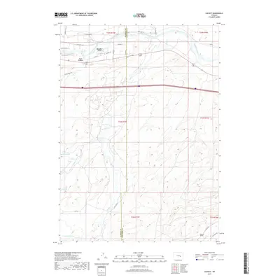
2017 Map of Lockett
USGS Topo · Published 2017About this map
The North Platte River winds across the northern landscape of this region, providing the primary hydrological anchor for settlements like Meadow Acres and the namesake Lockett. The terrain is defined by a series of drainage systems and reservoirs, reflecting the importance of water management in this Wyoming environment. Notable water bodies include the Wagner and Bayer Reservoir and McDonald Reservoir, which are fed by various creeks such as Goose Cr and the Clear Fork Muddy Cr.
Find a feature on this map
40 named features on this map. Tap any name to fly to it.
Don’t see what you’re looking for? This feature index may not catch every label — zoom into the map to look around manually.
Map Details
Editions of this 2017 Lockett Map
This is the sole edition of this map. No revisions or reprints were ever made.
Other maps of this area

1949 · Brookhurst
USGS Topo · 1:24,000

1949 · Campbell Hill
USGS Topo · 1:24,000

1949 · Parkerton
USGS Topo · 1:24,000

1949 · Glenrock NW
USGS Topo · 1:24,000

1949 · Pratts Soda Lakes
USGS Topo · 1:24,000

1950 · Campbell Hill
USGS Topo · 1:24,000

1950 · Lockett
USGS Topo · 1:24,000

1950 · Brookhurst
USGS Topo · 1:24,000

1950 · Parkerton
USGS Topo · 1:24,000

1950 · Glenrock NW
USGS Topo · 1:24,000