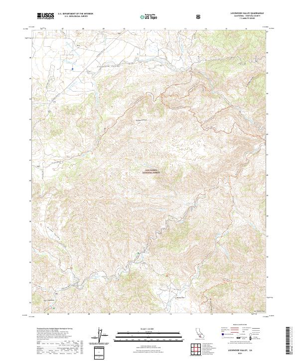
2021 Map of Lockwood Valley
USGS Topo · Published 2021About this map
Lockwood Valley serves as a high-altitude drainage basin within the Los Padres National Forest, where the waters of the Middle Fork Lockwood Cr and N Fork Lockwood Cr converge to form Lockwood Cr. The landscape is defined by its network of off-highway vehicle and pack trails, such as the Miller Jeep Ohv Trl and Yellowjacket Ohv Trl, which navigate the complex topography around Lockwood Peak. This network suggests a modern era of recreational land use superimposed on a traditional cattle-grazing and forestry landscape.
Find a feature on this map
43 named features on this map. Tap any name to fly to it.
Don’t see what you’re looking for? This feature index may not catch every label — zoom into the map to look around manually.
Map Details
Editions of this 2021 Lockwood Valley Map
This is the sole edition of this map. No revisions or reprints were ever made.
Other maps of this area

1903 · Mt. Pinos
USGS Topo · 1:125,000

1903 · Tejon
USGS Topo · 1:125,000

1942 · Frazier Mountain
USGS Topo · 1:24,000

1943 · Topatopa Mountains
USGS Topo · 1:24,000

1943 · San Guillermo
USGS Topo · 1:24,000

1943 · Sawmill Mountain
USGS Topo · 1:24,000

1943 · Cuddy Valley
USGS Topo · 1:24,000

1943 · Lockwood Valley
USGS Topo · 1:24,000

1943 · Lion Canyon
USGS Topo · 1:24,000
1943 · Devils Heart Peak
USGS Topo · 1:24,000