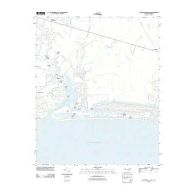
2010 Map of Lockwoods Folly
USGS Topo · Published 2010About this map
The Lockwoods Folly River dominates this coastal landscape as it flows toward the Atlantic Ocean, creating a complex network of marshes, channels, and landings. Settlement patterns here are tied closely to the water, with several established points of access such as Wildcat Landing, Dixon Landing, and Gores Landing serving the maritime communities. On the barrier island, Oak Island shows the structured street grid of Long Beach, while inland areas like Lennon Crossroads and Sandy Hill reflect a more rural, road-based layout.
Find a feature on this map
47 named features on this map. Tap any name to fly to it.
Don’t see what you’re looking for? This feature index may not catch every label — zoom into the map to look around manually.
Map Details
Editions of this 2010 Lockwoods Folly Map
This is the sole edition of this map. No revisions or reprints were ever made.
Other maps of this area

1943 · Funston
USGS Topo · 1:24,000

1943 · Holden Beach
USGS Topo · 1:24,000

1943 · Bolivia
USGS Topo · 1:24,000

1943 · Lockwoods Folly
USGS Topo · 1:24,000

1943 · Supply
USGS Topo · 1:24,000

1944 · Supply
USGS Topo · 1:31,680

1944 · Bolivia
USGS Topo · 1:31,680

1944 · Lockwoods Folly
USGS Topo · 1:31,680

1946 · Southport
USGS Topo · 1:24,000

1949 · Georgetown
USGS Topo · 1:250,000