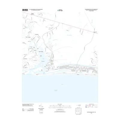
2013 Map of Lockwoods Folly
USGS Topo · Published 2013About this map
Oak Island and the neighboring coastal communities of Brunswick County are defined by an intricate network of tidal channels and river inlets. The Lockwoods Folly River serves as a primary artery, winding past numerous historical landings such as Mercer Landing, Varnams Landing, and Dixon Landing, which point to the area's maritime history. To the east, the Intracostal Waterway carves a straight path behind the barrier beach, separating the mainland from the dense residential grid of Long Beach.
Find a feature on this map
212 named features on this map. Tap any name to fly to it.
Don’t see what you’re looking for? This feature index may not catch every label — zoom into the map to look around manually.
Map Details
Editions of this 2013 Lockwoods Folly Map
This is the sole edition of this map. No revisions or reprints were ever made.
Other maps of this area

1943 · Funston
USGS Topo · 1:24,000

1943 · Holden Beach
USGS Topo · 1:24,000

1943 · Bolivia
USGS Topo · 1:24,000

1943 · Lockwoods Folly
USGS Topo · 1:24,000

1943 · Supply
USGS Topo · 1:24,000

1944 · Supply
USGS Topo · 1:31,680

1944 · Bolivia
USGS Topo · 1:31,680

1944 · Lockwoods Folly
USGS Topo · 1:31,680

1946 · Southport
USGS Topo · 1:24,000

1949 · Georgetown
USGS Topo · 1:250,000