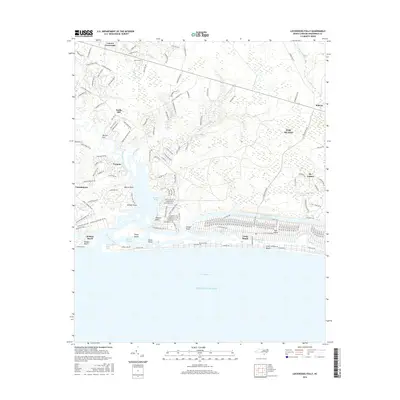
2016 Map of Lockwoods Folly
USGS Topo · Published 2016About this map
The Lockwoods Folly River dominates this Brunswick County landscape as it flows toward the Atlantic Ocean, meeting the tide at the Lockwoods Folly Inlet. This 2016 survey illustrates the intricate relationship between the mainland and the barrier islands, separated by the engineered path of the Intracoastal Waterway. To the east, the sprawling residential development of Oak Island is visible, including the communities of Long Beach and St. James.
Find a feature on this map
179 named features on this map. Tap any name to fly to it.
Don’t see what you’re looking for? This feature index may not catch every label — zoom into the map to look around manually.
Map Details
Editions of this 2016 Lockwoods Folly Map
This is the sole edition of this map. No revisions or reprints were ever made.
Other maps of this area

1943 · Funston
USGS Topo · 1:24,000

1943 · Holden Beach
USGS Topo · 1:24,000

1943 · Bolivia
USGS Topo · 1:24,000

1943 · Lockwoods Folly
USGS Topo · 1:24,000

1943 · Supply
USGS Topo · 1:24,000

1944 · Supply
USGS Topo · 1:31,680

1944 · Bolivia
USGS Topo · 1:31,680

1944 · Lockwoods Folly
USGS Topo · 1:31,680

1946 · Southport
USGS Topo · 1:24,000

1949 · Georgetown
USGS Topo · 1:250,000