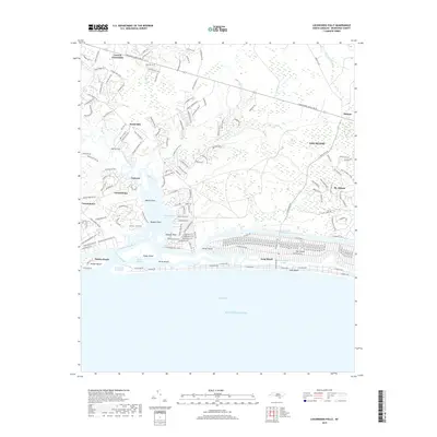
2019 Map of Lockwoods Folly
USGS Topo · Published 2019About this map
The Lockwoods Folly River dominates this coastal landscape as it flows past Varnum and Varnamtown before reaching the Lockwoods Folly Inlet. The map highlights the significant marine engineering and recreational development of the late 2010s, showing the precise path of the Intracoastal Waterway as it cuts through the marshlands north of Oak Island. Dense residential street grids at Holden Beach and Long Beach contrast with the inland agricultural and wooded areas around Lennon Crossroads. Of particular note to local historians are the established coastal features such as Mercers Mill Pond and Montgomery Slough, alongside named points like Genoes Point and Myrtle Point that define the irregular shoreline of the river estuary.
Find a feature on this map
38 named features on this map. Tap any name to fly to it.
Don’t see what you’re looking for? This feature index may not catch every label — zoom into the map to look around manually.
Map Details
Editions of this 2019 Lockwoods Folly Map
This is the sole edition of this map. No revisions or reprints were ever made.
Other maps of this area

1943 · Funston
USGS Topo · 1:24,000

1943 · Holden Beach
USGS Topo · 1:24,000

1943 · Bolivia
USGS Topo · 1:24,000

1943 · Lockwoods Folly
USGS Topo · 1:24,000

1943 · Supply
USGS Topo · 1:24,000

1944 · Supply
USGS Topo · 1:31,680

1944 · Bolivia
USGS Topo · 1:31,680

1944 · Lockwoods Folly
USGS Topo · 1:31,680

1946 · Southport
USGS Topo · 1:24,000

1949 · Georgetown
USGS Topo · 1:250,000