
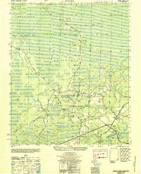
1943 Map of Lockwoods Folly
USGS Topo · Published 1962About this map
The coastal wetlands and maritime forests of Brunswick County are revealed here in a time before modern coastal development transformed the shoreline. The Lockwoods Folly River serves as the central artery, winding past numerous historical landings such as Mercer Landing, Wildcat Landing, and Dixon Landing. The map illustrates a landscape of scattered rural communities including Lennon Crossroads and Varnum Town, situated amongst the dense marshes and wooded tracts of Smithville and Lockwoods Folly. Along the Atlantic, the Intracoastal Waterway cuts a straight path behind the barrier islands, separating the mainland from Holden Beach and the shifting sands of Lockwoods Folly Inlet. This 1940s topography captures the region as a network of small family-named points and bends, like Genoes Point and Eastern Bend, which represent the early river-dependent economy of this section of Long Bay.
Find a feature on this map
34 named features on this map. Tap any name to fly to it.
Don’t see what you’re looking for? This feature index may not catch every label — zoom into the map to look around manually.
Map Details
Editions of this 1943 Lockwoods Folly Map
This is the sole edition of this map. No revisions or reprints were ever made.
Other maps of this area

1943 · Funston
USGS Topo · 1:24,000

1943 · Holden Beach
USGS Topo · 1:24,000

1943 · Bolivia
USGS Topo · 1:24,000

1943 · Supply
USGS Topo · 1:24,000

1944 · Supply
USGS Topo · 1:31,680

1944 · Bolivia
USGS Topo · 1:31,680

1944 · Lockwoods Folly
USGS Topo · 1:31,680

1946 · Southport
USGS Topo · 1:24,000

1949 · Georgetown
USGS Topo · 1:250,000
1950 · Supply
USGS Topo · 1:25,000