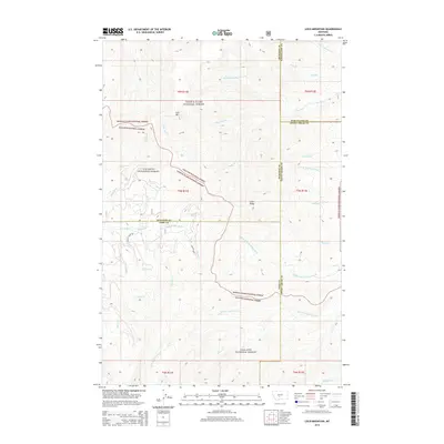
2014 Map of Loco Mountain
USGS Topo · Published 2014About this map
Loco Mtn and Lebo Peak dominate this high-altitude landscape within the Lewis & Clark National Forest and Gallatin National Forest. The map documents a complex drainage system where the headwaters of the Shields River meet numerous forks of the American Fork and Big Elk Creek. The Shields River Rd provides the primary access through the southwestern portion of the quadrangle, following the river valley as it cuts between the mountain slopes. Researchers can trace the hydrography of the region through features like Elk Lake and the various tributaries including Lebo Fork, Scofield Cr, and Turkey Cr. The geography is further defined by the convergence of several county boundaries, including Meagher, Wheatland, Sweet Grass, and Park counties, illustrating how these natural mountain barriers serve as political borders in the Montana wilderness.
Find a feature on this map
38 named features on this map. Tap any name to fly to it.
Don’t see what you’re looking for? This feature index may not catch every label — zoom into the map to look around manually.
Map Details
Editions of this 2014 Loco Mountain Map
This is the sole edition of this map. No revisions or reprints were ever made.
Other maps of this area

1886 · Little Belt Mts.
USGS Topo · 1:250,000

1894 · Little Belt Mts.
USGS Topo · 1:250,000

1897 · Little Belt Mts.
USGS Topo · 1:250,000

1898 · Little Belt Mts.
USGS Topo · 1:250,000

1902 · Little Belt Mts.
USGS Topo · 1:250,000

1948 · White Sulphur Springs
USGS Topo · 1:250,000

1958 · White Sulphur Springs
USGS Topo · 1:250,000

1961 · White Sulphur Springs
USGS Topo · 1:250,000

1965 · White Sulphur Springs
USGS Topo · 1:250,000
1972 · Virginia Peak
USGS Topo · 1:24,000