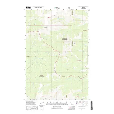
2017 Map of Loco Mountain
USGS Topo · Published 2017About this map
Loco Mountain and Lebo Peak anchor this high-elevation landscape where the Lewis & Clark National Forest meets the Gallatin National Forest. This 2017 survey details a complex hydrological network at the intersection of Meagher, Wheatland, Sweet Grass, and Park counties. The Shields River and its various tributaries, such as Lodgepole Cr and Fawn Cr, drain the western slopes, while the eastern drainage is defined by the headwaters of the N Fork American Fork and Big Elk Cr. The map illustrates a transitional wilderness where timbered slopes give way to the prominent peaks of the Crazy Mountains. Human impact is primarily limited to resource management and access, represented by Shields River Rd and a network of creeks like Turkey Cr and Scofield Cr that define the local topography.
Find a feature on this map
40 named features on this map. Tap any name to fly to it.
Don’t see what you’re looking for? This feature index may not catch every label — zoom into the map to look around manually.
Map Details
Editions of this 2017 Loco Mountain Map
This is the sole edition of this map. No revisions or reprints were ever made.
Other maps of this area

1886 · Little Belt Mts.
USGS Topo · 1:250,000

1894 · Little Belt Mts.
USGS Topo · 1:250,000

1897 · Little Belt Mts.
USGS Topo · 1:250,000

1898 · Little Belt Mts.
USGS Topo · 1:250,000

1902 · Little Belt Mts.
USGS Topo · 1:250,000

1948 · White Sulphur Springs
USGS Topo · 1:250,000

1958 · White Sulphur Springs
USGS Topo · 1:250,000

1961 · White Sulphur Springs
USGS Topo · 1:250,000

1965 · White Sulphur Springs
USGS Topo · 1:250,000
1972 · Virginia Peak
USGS Topo · 1:24,000